Monday, April 25, 2011

Chewing up the miles to Oaxaca (4/21/11-4/25)

Villahermosa
 
along the same road
along the gulf coast
With the heat and humidity of the low elevations, I decided my next destination would be to go back to one of my favorite cities, Oaxaca. This would seem to be the perfect place to wait out the holiday (no bodies of water up there), and the nights would be drier and cooler. Villahermosa is basically halfway and they have a campground so that's where I headed.


south of Champoton
The road hugs the coastline all the way down to Champoton where there are large crowds already gathering along the waterfront. I go through a federal police checkpoint where the cop asks me for 15 pesos. I didn't think the federal guys did this stuff, so I give him my " are you fucking kidding me?" look. He points to the hot sun above and says, "necessito agua". Well, okay, it is only 15 pesos. Either he really did want to buy some water, or it was the most pathetic bribe ever. After Champoton the road heads directly south and then southwest towards Villahermosa. The picture at left shows what a lot of the remaining drive looked like, which isn't much. The roads were fast, however, and I was able to do the 285 miles from Campeche in 6-1/4 hours.

Campeche to Villahermosa.
black is prior trip
People often will camp at balenarios, which are large swimming pool/picnic resorts found throughout the country. I had never stayed at one until now. This was conveniently located just west of Villahermosa and when I pulled in I was met by Crystal, a young woman originally from Chicago and part of the family that owns the place. The large crowd - this was the Thursday before Easter - was beginning to leave for the night when I got there at about 5:30. Crystal said this was nothing, they will see up to 5000 people a day over the weekend. It's a big pool, but 5000? That's a whole town! It's a nice stopping point, but I'm outta there early in the morning.

Oaxaca

crossing the mountains
west of Orizaba
 I knew I had a long drive in front of me so I hit the road at 8am. There is a cuota heading north all the way up to Mexico City so I jumped on it to cover some distance. I was looking for the exit about halfway up for the mountain road that goes to Oaxaca called Mex. 175, but I never saw it. A couple of hours later I'm almost to Puebla! Now I have to drive back south via another cuota that I used 6 months earlier. Bottom line, I drive for 9 hours and cover 492 miles, by far the most I've ever driven in one day down here. It costs me over $100 in gasoline - lucky for me gas is only $2.93 a gallon in Mexico right now. I also spend $65 on the tolls, another record. Mexican toll roads are notoriously expensive and I usually avoid them.


Villahermosa to Oaxaca.
black is prior trip

As I enter Oaxaca I'm struck by the lack of traffic. This is my third time here and the first time that traffic has been so light, laid-back even. No pressure, no horns, I guess most people really do head to the ocean. When I get to the San Felipe Campground it takes about 5 minutes of ringing the bell before Doug ambles down to unlock the gate. You can see my Doug story in a post from back in October. Everyone has left for the season so the campground is all mine for the next 4 nights. I spend most my time here amidst Doug's agave plants being serenaded by the countless dogs, roosters and at least 2 donkeys that live in these hills. Real Mexico.

Tomorrow I head to Puerto Escondido and then points north to...Estados Unidos, in maybe two weeks. I left Golden, CO 217 days ago. It's been a while.


Saturday, April 23, 2011

Merida and Campeche (4/18/11-4/20)

Merida

the road to Coba
It was a struggle to get myself to leave Xpu-Ha, but knowing the Semana Santa crowds were coming finally lit a fire under me. The long Easter weekend is the busiest and much of Mexico moves to wherever the water is during this time. I bought a t-shirt - not my favorite but the only one that fit - and started south back to Tulum and then inland towards Coba. This road, too, has been much improved since I was here 5 years ago and it's a fairly monotonous, straight, flat drive at high speed all the way to Valladolid, with a couple of checkpoints along the way.

Whenever I think I've seen Mexico (or Central America, for that matter), I find stuff to give me an excuse to come back. Valladolid and the surrounding area is one. My desire to push on, though, trumps wanting to explore any further so I settle for lunch at the Hacienda Ticuch. This is an institution in these parts with a reputation for good food. It's a big place but for a late Monday lunch it's just me. I only have the chicken tacos with the refried beans and habanero salsa, but it's obvious this restaurant deserves serious study, like a dinner, or three. From there it's the fast cuota (toll road) to Merida. The Yucatan is not only flat, it's hot right now. For the first time on this trip the car thermometer hits 100 and tops out at 102. Not the best sleeping weather.

tent city
There is a ring road that goes north of the city and I find a gigantic SuperWalMart to fill up on all kinds of American goodies. Then over to the nearby Rainbow RV Park. Again, I'm the only one here and the owner says she hasn't had much business this year due to the border issues. This is an older park (it's one of those that doesn't believe in toilet seats...awkward), but it's the only one around. At 10:30pm a tour bus rolls up next to me and maybe 50 people get out and set up their tents in the dark. So much for no business. I'm pretty sure this is a holiday crowd heading for water and they seem more interested in sleep than a party. Next time through here I think I'll get a room in the central part of Merida. This city deserves a couple of nights.

Campeche

along the malecon
About 2-1/2 hours along more good road and flat country and I'm driving the malecon in Campeche. After attempting to drive into the historic district to find a hotel with parking (narrow colonial streets + lots of traffic = hopeless gringo), I opt to take an expensive 4-star hotel, the Ocean View, on the malecon for over $100/night. I figure this will be my last real splurge, so what the hay. And after 17 days straight in the tent, I'm glad to be in nice bed with tons of hot water to shower in. Not to mention an impressive continental breakfast. I got my money's worth right there.


a side street
early evening
The malecon itself fills up with people out for early evening walks or jogs and is the place to be to watch the sunsets. In-land a couple of blocks is the historic colonial part of town with a very nice zocolo and cathedral. To quote Lonely Planet, "Campeche is a colonial fairyland, it's walled city center a tight enclave of perfectly restored pastel buildings, narrow cobblestone streets, fortified ramparts and well-preserved mansions." Exactly. Campeche built these huge walls and bulwarks after a brutal pirate attack in 1663. It took 50 years to complete. Today, only the seaward wall and the opposite landward walls survive, but they are well preserved and lit up at night and there are Disney-like re-enactments of the pirate fiasco several nights a week on the Puerta de Tierra. I thought it was kinda cheesey.

cochinita pibil
the Yucatan. Black is prior trip.
click to enlarge
Every region of Mexico has it's own culinary specialties and one of the most famous for the Yucatan is cochinita pibil. This is a pork dish marinated in acidic fruit juice (usually orange) with local Mayan spices, then slow-roasted in banana leaf and served with salsas - habanero is always one - corn tortillas, refried beans and pickled onions. The meal I had at Marganzo was out of this freaking world. Sweet and spicy and oh, oh, so tender, with some of the outer bits almost caramelized. Put some of the habanero on it in a tortilla, squeeze some lime. Someone, please tell me where I can get this in Denver!! This is the number one dish I need to learn how to make.

Xpu-Ha (4/6/11-4/17)

The Ride Up

road north to Tulum
After paying Reiner, I drove east to see how Majahual has changed since it took a direct hit from Hurricane Dean in 2007. I had spent 4 days there in 2006 camped in my VW van on main street while various locals tried to help fix my VW overheating problem; at times comical or worrisome, but always interesting and memorable. (I was eventually able to get south to Chetumal where a dealer had the necessary part). I was going to try and look up some of those folks, but the hurricane wiped out much of the town as I knew it. Things have been rebuilt - including the cruise ship dock - but now it definitely has the look and feel of a town built by and for the cruise ships. In fact, there were two big ships there when I arrived. Sorry, not my style. R.I.P., Majahual.

It seems like the entire road north has been repaved and widened as the drive is mostly flat, straight and fast, just like in the picture. Even with the Majahual side-trip I'm able to cover 200 miles in less than 4 hours.

Xpu-Ha  

more Xpu-Ha
Xpu-Ha
This trip would not have been complete without a return to the beaches at Xpu-Ha, specifically La Playa (or, Chalio's beach). It was my favorite location 5 years ago -I stayed 10 days - and it still is. It's just that now I can also compare it to all the beaches I've seen in Central America, and I saw some great beaches.


best campsite of the trip
I was hoping that the spot I occupied back then would be available again, and I was very happy to see that it was. It only took a few minutes to find Chalio sitting under a palapa and we quickly agreed on a price and that I could, indeed, park where I had before. First, I had to make a quick run into Playa del Carmen to the Toyota dealer to schedule my 5000 mile maintenence. They were able to fit me in that afternoon and I had my tent up as dusk was settling in. I didn't move for 12 days.


12 Days 

the model
more X
Every day was like Groundhog Day. Perfect skies with a constant breeze, perfect water at the perfect temperature. I had no agenda but to hang out. I stared at the sea and the beach and the sky...a lot. The colors, it's the colors, man. They had me totally mesmerized and hypnotized and, finally, lobotomized. I had no reason to stay, no reason to leave.

This beach has a large restaurant that caters to day crowds of bused in cruise-shippers and jeep tour groups. Even they couldn't take me out of my trance. I might go in the water once or twice a day, even broke out the snorkel gear once or twice. I might do some reading, or maybe take a walk (do I go left or right today?). Another day I got to watch a photo shoot with a pretty model, so I took a few of my own. She's okay.

at Tacos de Arbolito
Chalio tossing the net for
dinner...he caught 15
The best part of this beach is the people who live here. From day 1, I was lucky enough to be "adopted" by Audrey, an expat who has lived here for years and is a dive instructor. She was often a helpful interpretor and drinking buddy, along with Damian, who captains the dive boats and is one of Chalio's best friends. The three of us had some really good, simple meals in the nearby town of Puerto Aventuras where the locals serve up very good - and cheap - food. Tacos, tortas, shrimp, beans, etc., usually with corn tortillas and a habanero salsa of some sort. The tacos pictured were especially awesome, I'd eat there every week. Then back to the beach for beers, tequila, and repeat (until I'd start yawning).

l. to r. Damian, Vickie, Audrey, Jackie,
me, Chalio, Lorena
The picture at left was taken at a birthday barbeque (unbelievable pork ribs). Vickie and Lorena are friends of everyone, Jackie is Chalio's daughter. A few days earlier Jackie broke out a bucket of oysters on the beach which we downed in shot glasses filled with tequila, sangrita and lime juice. It was fun. 

And then there is the man himself, Chalio. He owns the beach, has lived here all his life and understands these waters better than anyone (see above picture where he easily plucked out dinner...with a net), and is really down-to-earth, enjoys every day. It's a privledge to know him even a little bit, to have shared food and drink with him, with everyone who calls this beach home.

I want to go back.


Thursday, April 14, 2011

Laguna Bacalar (4/4/11-4/5)


roadside view of the laguna

A few miles after leaving the border, I'm detoured to the side of the road where I need to pay $5 for the fumigation of the FJ. Then it's clear sailing to the north on perfect 4-lane highway. A lot of this looks new to me since 5 years ago, including overpasses built to gain access to places I never heard of.

view from the campground
The town of Bacalar is on the southern end of the laguna, but the campground I'm looking for is on the sparsely populated north shore. About 2 miles in from the highway on  a dirt road is the Laguna Azul Campground, run by Reiner and Elga, from Germany. Reiner welcomes me  and says to park anywhere; there are about 8 spots available and no one else is here. As hot as is I pick the one with the most shade potential. The laguna is a beautiful shade - or shades - of blue, the result of all the limestone. It's also the only place to stay cool and away from the local brown flies that like to bite, and the reason I only stayed two nights.

Elga cooks up a delicious breaded pork chop with fries and a salad, and Reiner makes a potent margarita. I have the same dinner both nights. Reiner tells me what all this looked like back in 1978 when he first came through as a college student. Back then it was a slow road with almost zero traffic and Playa del Carmen really was a small village. Wish I had come down then.

Saturday, April 9, 2011

Orange Walk/Lamanai and B13 (4/2/11-4/4)

Orange Walk

a road of my own
Safely back with Big Yellow, I drive the edges of Belize City to get the road north. Belize City, from what little I saw, is not a place to hang out for vey long. See ya, B.C., kiss my...! The next hour and a half is more flat, straight roads going through sugarcane country.

the field behind Victor's
On the east side of Orange Walk is a campground called Victor's. It's in a country setting and the place is basically a rundown farmhouse with a shabby restaurant and shabby cabanas in the back where the field is, which is where I park. Sonya is the owner and she shows me around; I get to use one of the cabana bathrooms. She walks me to the restaurant and orders me the house specialty, a roast pork dish that is pretty good. One of her granddaughters, maybe 8 years old, joins us and she sings a song for me in Spanish. Very cute.

Around 6pm I'm at my tent when the first cabana customers show up. Turns out Sonya - this sweet little grandmother - rents these rooms out by the hour. And I'm supposed to use one of those bathrooms? Heavy on the 'ick' factor, I elect to not use the shower for my 2 nights here. Sonya is otherwise kind enough to call one of the local tour operators to pick me up in the morning to go to the Mayan ruin of Lamanai, the only reason to spend any time here.

Lamanai

this be Juice
the New River
Though I'm basically over the Mayan rock thing, Lamanai is different because you get to take a 1-1/2 hour boat ride down the New River to get there. This is a beautiful jungle river with some monkeys, crocs, iguanas and birds along the way. I share the small motorboat with a family of 4 from Seattle, and our captain is Hugo, also known as 'Juice'.


atop the High Temple,
do I need a haircut?
the view down
When we arrive at the Lamanai dock another, larger boat with maybe 20 Air Force people on it pulls in to join us on the tour. They also have our lunch. No surprise, it's stewed chicken, rice and beans. The tour takes about 2-1/2 hours and it's a pretty interesting site. We climb the big High Temple which rises above the treetops and affords great views in all directions. I like this ruin site, maybe it won't be my last one, afterall.


boat tugging sugar barges
They serve us some rum punch before taking the ride back. Juice gets us to Orange Walk and drops us off at the riverside restaurant that also has a few rooms. The Seattle family is staying here and they say the rooms are quite nice. The owner says I could have camped on his large lawn, next to the river, for the same price as I'm paying at Victor's. I wish I could remember the name because it is far superior and has an attractive restaurant. Anyway, if I'm ever in Orange Walk again this is where I'll stay.


B13 = Mexico

the bridge back to Mexico

Only one hour through more sugarcane and a few clean towns (Belize really does have the cleanest roads in all of Central America) and I'm at B13, a few miles north of the town of Corozal. Once again, everything for Belize is in one building and it takes maybe 15 minutes to process myself and the car out. They also collect about $19 as a fee for my being in their country. See my previous post for the Belize map.

Over a bridge and I'm back in Mexico. After 161 days and some 6200 miles I leave Central America. I feel a little relieved that I was able to pull this off without a single incident, but a little triste (sad) that the trip is winding down. Without much time to reflect, I enter Mexican Immigration to have my passport stamped and then over to the Aduana next door for the FJ. I have copies of all my paperwork, but the man wants a copy of a single piece of paper that Immigration gave me. There's a copy machine somewhere "over there". I end up walking 3 blocks into the adjacent town before finding the little tienda where a woman in the back will make a copy for 20 cents. A completely stupid set-up but this is my last border before the U.S. so, no problema. $36 to pay for a new vehicle stamp and another 180 days in-country if I want it.

Now, where's all that good food at?

Friday, April 8, 2011

Placencia to Cay Caulker (3/28/11-4/1)

Placencia

the Hummingbird Highway
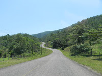
One of the nice things about going to Placencia is having to drive the Hummingbird Highway again (I was down here 5 years ago). Once you get past the capital of Belmopan - a total yawner - it gets hilly and green like in the picture. Plus, it's a great name for a road.
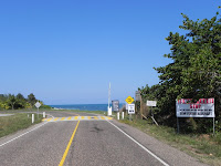
end of local Placencia airport at left,
important sign on the right
The branch road off the Southern Highway that goes to Placencia was only completely paved 4-5 months ago, making the drive pretty straightforward. This area is being pushed as the next big thing as an international airport is being built back where the road branches off. There are 'for sale' signs everywhere on the 22 mile long road that runs down the skinny penninsula, especially the lower half.
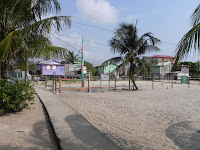
part of the sidewalk system
The town is still small with just the single, and very busy, road ending at the dock. Otherwise, there are concrete sidewalks connecting the town along the beach. The beach: it's what Placencia has and the rest of mainland Belize does not (Hopkins to the north has a thin beach, too, but I hardly count that). Strangely, unlike a typical Caribbean beach this sand isn't white sugar, but a rough tan-ish sand and not all that much fun to walk on. Parking is at a premium here so I take a room I don't like for too much money that at least has a/c since it's hotter than hot.
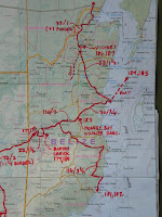
11 days in Belize
click to enlarge
 One day around lunchtime I was walking by the dock when a large local woman who was cooking up some food says to me, "hey, big boy, you want some of what Brenda's got cooking?". This sexual innuendo makes me laugh and Brenda and her girlfriend really turn on the charm and so I sit down for the standard Belizean meal of stewed chicken, rice and beans. Pretty good for a good price. We continue to throw one-liners back and forth (Brenda even starts rubbing my shoulders!), then, when I'm leaving I notice a starfish right next to us in the water. I say, "maybe you could slap that starfish on the grill, how would that taste?" Brenda comes back with "how about you slap your dick on the grill?" Her girlfriend adds, "slap it between your legs, you mean?" Wow. And Wow, again. That's my Placencia story.

nice idea, but I wouldn't bet on it
Placencia doesn't really do it for me (Brenda notwithstanding) and I probably won't be back. That said, I guess between the new airport and all the real estate biz going on, this area will explode at some point. And Francis Ford Coppola has his own resort (Turtle something) right at the entrance to town, so lots of other people - people who can afford to live anywhere - love it.


Monkey Bay
Monkey Bay...it's flat around here
On my way back up the Hummingbird I have to stop for gas. Welcome to the future: $5.62 a gallon = $96 for 17 gallons. Hello!

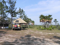
In only 3 hours I make it north to the Monkey Bay Wildlife Sanctuary just off the highway. They are a research facility with some tours and facilities for university students and some campers. The students happen to be away for a few days so the place is all mine for the night. This is a great rest stop if you're ever driving through, only $8 and with very clean facilities and free filtered water to drink (and to reload with) and great wifi in the library.
harpy eagle
white-fronted parrot
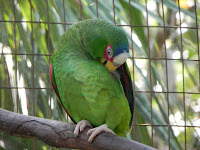
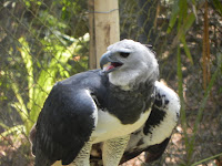
A reason I stayed here is that the Belize Zoo is only 5 minutes down the road. People have told me it's really worth it, so I pay my $15 and cruise around. It's pretty small but the reason they are here is that it's a home for animals that were caged or abused or who for some reason can't be put back into the wild. Lots of birds, crocs, jaguar, most anything that would be native to the area. The harpy eagle (picture) is the world's most powerful bird of prey and the national bird of Panama. 75-90 minutes is all it takes to see everything.

Cay Caulker

A drive of less than one hour across very flat, boring country and I'm on the outskirts of Belize City. There is a marina there where people park their vehicles for safekeeping before heading over to the cays. A nearby food shack is serving up the usual (Rosie is cooking) and the shack owner is a Canadian expat, Don, who offers to give me a ride into town to the boat dock to Caulker. You meet the nicest people.
main street
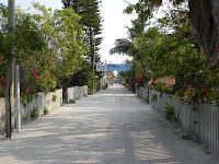
The boat ride takes about 40 minutes, costs $17.50 for a round-trip ticket and is fairly smooth as it's all within the reef. I have no idea where I'm going to stay when we land, but there is a rental shack on the main street and the lady points me towards the Tropical Paradise. Main street is white sand as are all the streets on the island. And only golf carts, no cars.
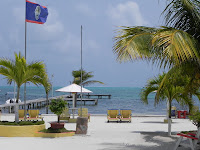
view from the Tropical
The Tropical (the hotel, not the old bar in Belmar, NJ) is at one end of main street so it's quiet and it's clean with a decent restaurant. I was going to get one of their $20 rooms, but it was still so hot that when the woman mentioned a/c, I said "yes, please". That cost $50, but worth it.

another budget buster
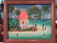
 I expected wall-to-wall partying on this island just by how the guidebooks write it up, but I found the island to be more subdued and the people friendly. Typically, the Rasta-looking guys all thought I'd be interested in buying their shit. No thanks, bro. I only stayed two nights to do more of a scouting of what a cay looked like. Now I kinda wish I had done one of the snorkeling tours, they're supposed to be pretty darn good. Bottom line, I would come back to the cays, maybe even do one of those 3 day sailing trips from Caulker to Placencia. It's probably more fun, though, if you know the other folks on the boat. I made the mistake of walking into a local art gallery and couldn't get this painting out of my mind. It's an original acrylic by Walter Castillo, one of the best known Belize artists. I also bought a mahogony clam chair up in the Cayo District...a fucking chair! I need a bigger car. And a bigger storage unit.

Tuesday, March 29, 2011

Barton Creek (3/24/11-3/27)

on my way to Barton Creek

camped next to the creek
After 2 nights at a campground just west of the mountain town of San Ignacio - where I did some spring cleaning, recharged my aux. battery and put some air in the tire that doesn't leak - I spent 1-1/2 hours wandering the hills and dirt roads to the southeast (I drove a grand total of 22 miles) to find the next campground, Barton Creek Outpost. This was a tip given to me by the Norwegian campers I met in Guatemala.
 
finally, a wild toucan shot...yes!
Barton Creek is a neat little hideaway on a corner of the river owned and run by Jim and Jackelyn, ex-navy divers, which is pretty cool. They cater to backpackers who either bring their own tent (and attached car) or you can rent one, and they now have a bunkhouse. For my two nights here there are only four, then three, other people. The main attractions for me are the peace of the river and the swimming hole that I can camp right next to. The water is the perfect antidote to the hot weather that is becoming more uncomfortable by the day. It's urging me north at this point.

local Mennonite
Notice please, my toucan photograph. A bit blurry, but it just showed up suddenly and I had to go to digital zoom without a tripod so I'm happy. My two nights here marked 10 days in a row of camping, a record for Central America. This part of Belize is home to many Mennonites, several wagons of whom I passed on the drive back to the highway, like this one crossing the river ahead of me. I love this part of the country.

Sunday, March 27, 2011

B11 to B12 (3/18/11-3/23)

El Florido

best border building in C.A.?
It's not even 15 minutes from Copan to the border crossing at El Florido, barely enough time to get my drawers all up in a bind. Surprise, surprise, a Honduran border run professionally and smoothly. B11 refers to the fact that this is the 11th border crossing of this trip, being that there are a total of 14 of these suckers to deal with. I'm not even allowed in the new building pictured; a guy with a shotgun makes sure of that. A woman grabs my passport and vehicle papers, disappears for 10 minutes, then hands my stamped passport back to me and I'm told to drive forward to immigration to get myself processed out. They also stamp my passport and I'm out of Honduras. No charge for any of this (are you listening, El Amatillo?)

When I park on the Guatemala side a woman who works with their tourist department asks me a bunch of questions about my time in their country. That's a first. I think (?) because a lot of tourists use this border to get back-and-forth to Copan that both countries have made an effort to make this crossing somewhat pleasant. Even the costs of services are posted. I get stamped into Guatemala for a cost of 10Q ~$1.13. Then, it's over to the aduana building to process the vehicle. There are some truckers ahead of me and the woman doing my paperwork is quite slow - let's say she's diligent - so this takes about 45 minutes. I pay 55Q for the car and I'm free to drive forward after about 1-1/4 hours.

Rio Dulce

part of dock at the Nana Juana
It takes me about 3-1/2 hours to make the drive from El Florido to Rio Dulce, the first half of which is through dry, brown country, and I don't think I saw one thing that was pretty or interesting. Didn't  even take a picture. Later, it turns green and hilly, but it's overcast the whole way. The main highway that goes east-west here carries lots of traffic and the semis are thick and fast on this 2-lane road. I have - at least in my mind - a "Duel" situation with one truck that's behind me for a couple of hours. Every time I thought I shook him going uphill, he tracks me down passing other cars and trucks going like 80. But he never passes me. It makes me nervous. When I turn north on the road to Rio Dulce he continues east. Lucky for him.


I'm allowed to use the pool
 I read that one could camp at the Hotel Nana Juana on the river. The Rio Dulce goes out to the Caribbean and yachters come in here to dock and relax or to get protection from storms. This place caters to that crowd and it's a pretty nice location and they have a good restaurant right on the water. I don't get to camp on the pretty side of the hotel, however. I'm directed to the other side, along the boat storage area. At least it's secure, has hot showers and it's quiet at night

The reason I'm here is to take a boat tour from Rio Dulce out to Livingston, out on the coast. It's supposed to be a really nice day-trip and I so wanted to go on this trip that I waited through 4 days of on-and off rain before finally giving up. I didn't want to do this trip unless it was blue skies, which it never was. Jean Claude, the hotel manager, said the weather this time of year is "usually perfect". This is the most rain I've seen in 6 months. Time to move on.

Finca Ixabel

north into the Peten
Less than 2 hours north is this farm started by a couple of young Americans back in the early '70's when this was still remote jungle. The husband was murdered by some Guatemalan army guys about 20 years ago, but she has persevered, see their website.  Now, the road is paved and much of the surrounding rainforest is ranch and farmland. If you've ever read about traveling in Guatemala you've read about Finca Ixabel. It's turned into a sprawling farm/summer camp for adults. They have rooms, treehouses, a swimming hole, restaurant (famous for their bread and cinnamon buns) and a large area where one can camp for $3US. I had to check it out for a night, it's very peaceful.

scoping out Finca Ixabel
 Another first for this trip: a couple from Norway drive up in their seriously loaded LandCruiser...with a rooftop tent! Unfortunately for them, it's an inferior ARB tent, but it's still a tent. They're doing the trip down to Chile. I'm losing track of how many people I've met doing that trip. It reminds me I need to take that trip, hopefully before I turn 60. There are still some spots I've missed in Central America so I figure two months from Denver to Panama and then 10-12 months to go from Columbia to Chile to Venezuela. Who'll go with me? Don't all jump at once.

Tikal

temple 5
Another 2-1/2 hours north through much the same kind of hilly jungle/ranchland on a good road takes me to the giant Mayan site of Tikal. There is a hostal/hotel across from the main parking lot called The Jaguar where you can rent a tent or bring your own. I end up parking next to Cindy and Steve, a young brother and sister from Fort Collins. If it wasn't for location, this hotel would suck as they have a noisy generator they like to run between 6-9 at night. Once that turns off, though, there is only the sound of the jungle, and the howlers were especially loud at times, like they were right on top of us. And there were some spider monkeys playing around in the trees for awhile.

People were leaving the campground at 4:30am to get to one of the temples where you can watch the sunrise over the jungle. Screw that, I head in at 6, which is barely light as it is. Well, this day the fog was low and thick and no one saw anything. After about 3 hours of wandering around I'm burned out on rocks at which time the skies begin to clear. Of course. Having seen like a dozen of these sites I find it difficult to get excited anymore, but it is certainly one of the most impressive Mayan sites, if you're into that sort of thing. I can check it off my list.

Melchor de Mencos

Belize is on the other side
30 days hath Guatemala
click to enlarge
 Time to move on to Belize, a 2 hour drive east to this border town, B12. Another surprise, both countries are still open for business even though it's lunchtime. These borders are starting to kill me with kindness. Guatemala charges me $4 to exit. Not sure why, since it cost nothing when I left the country some 4 months ago. I'll never understand the inconsistency between borders of the same country. But, it's quick and painless and I then drive through a fumigation machine and into Belize. This costs $5. Next, it's into a building that holds both immigration and the aduana. No further cost to process me or the car (I think I pay when leaving). One last stop is the insurance building. You need to buy car insurance and it costs me $23 for 2 weeks. 1-1/4 hours of border b.s. and I'm free to enter Belize, the land where the locals speak English and the roadsides are clean.