Wednesday, May 18, 2011

Colorado and The End (5/15/11-5/17)

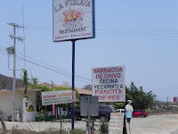
the best road sign
last campsite of the trip
North of Shiprock I cross into the great state of Colorado and the Southern Ute Reservation. They have, like every other tribe it seems, a casino. Where do all these gamblers come from? I stopped here for the night since they have a nice campground. I walked through the casino, and it's no different than any other...it sucks. Boring, depressing, ding, ding, ding, etc. Give me a break.


climbing the hills north of Durango

north of Silverton

The next day I take the beautiful drive from Durango north to Ouray and beyond. This has to be one of the best drives on the planet. Winter is still very much alive up here right now. I end up in Crested Butte for the evening and it's snow flurries in the morning! I don't even know where my long pants are right now, and I turn on the heat in the FJ for the first time in maybe a year.


back in Golden...nice day, huh?
About 4 hours takes me to my old stomping grounds of Evergreen and Golden. I made it, no worse for wear, I think. 239 days and almost 15,000 miles. When you get down to it, it was simply a long and beautiful drive. And I'd go back. Over my two trips south - some 24,000 miles of driving over 384 days in either Mexico or Central America - I've not had a single incident. The government has their stats, and that's mine.

Well, I need to find a job, so this is the end of the trip and the blog. Thanks for following along. See you further on down the road.


                                                                                     The  End

Tuesday, May 17, 2011

The Rest of New Mexico (5/11/11-5/15)

Pie Town

the museum and research center
After spending the night at Brantley Lake State Park up the road from Carlsbad - pretty, but windy - I drove north to Roswell. I expected a dorky, UFO-centric town but Roswell has every appearance of a prosperous, clean city. Rather than stopping and looking at all the alien crap, I snapped a picture of the "research" center. Hope they're learning shit in there.

west towards Socorro
West of Roswell the land rises and goes through some nice pine-covered hills. One of the towns you drive through is Lincoln, where Billy the Kid killed some folks and then escaped from jail. Things went downhill for the young lad soon after that. West of there is more desert all the way to I-25 and Socorro, where I call it a day.

very small part of the VLA
My next stop is Albuquerque to visit my good friend Scott. It's only Thursday and he has to "work" so I decide to drive west for the day to visit Pie Town. I had seen a show on PBS a while back that was documenting the Continental Divide Trail and the people walking it. The Divide goes right by Pie Town and so hikers stop there to rest and treat themselves to pie. Who could resist? Along the way you drive by/through the Very Large Array, which is Very Impressive.

the pie store
Next up is Pie Town. This is a two-store town and the one I had seen on tv is closed today. There is one other right down the road so I stop there; I will not be denied pie. I have a slice of chocolate cream with whipped cream and coffee and it's excellent. I want to buy an apple pie to take with me to Scott's and they have a warm one just out of the oven. Fair warning: they charge $25 for a pie. They're good, but not that good, unless you're a tourist who doesn't care, just this once.


Albuquerque

La Ventana
Pie in tow, I head north on a dirt road that takes me through wide open ranch land on the way to I-40. Lots of big sky with distant mountains. Back on a paved road still heading north you drive by the La Ventana Natural Arch. No one else is around and it's very peaceful to hang out there for a bit before moving on. After that, I get to I-40 east and it's standard, scrubby desert all the way to Quirky Town, with the occasional Indian casino along the way. No thanks.

Work day over, Scott calls and gives me directions to his house. It's great to see him after 5-1/2 years. We go back some 26 years, afterall. His 3 youngest daughters are there, Katie, Taylor and Tara (twins who have great singing voices). Scott grills up some good chow for everyone, the adults have a few beers, and we catch up for the remainder of the evening.

Scott, the Hulk and me
Rte. 66 marker
Friday morning Scott has a 1/2 day of work, but after that he gives me the tour of downtown Albu. including the historic Route 66 area where we have lunch and stop at the motel where they shot scenes of "No Country for Old Men". Later, we play 9 holes of golf at a local course (they're not nearly as crowded down here). The beer cart lady took this picture of us. Scott loves his Hulk head cover, obviously. Hope I don't have to wait another 5-1/2 years.


Taos
 
the Taos square
along the river to Taos
North on the interstate up to Santa Fe, which I only drive through. It's about 3 hours to reach Taos and the first thing I do is check out a campground about 5 miles outside of town next to a creek. Looks like it'll do the trick, so I head back to scope out the historic downtown area. If you are allergic to adobe or art galleries then you might want to skip Taos (and, probably Santa Fe, for that matter). Not that there's anything wrong with that. I happened to like Taos, even if I did sneeze a few times...it could have been the pollen. Had lunch on the square which was nice, albeit kinda expensive. My only suggestion is that they shut the square off to traffic, who needs it. Sleeping by the creek was great even if it did get down to 44 in the morning. Brrrr.

West to Colorado
 
different kind of home
view off the bridge
This drive takes about 5-1/2 hours to go 268 miles where I end up back in Colorado! More about that later. Heading west from Taos the first thing of note is the Rio Grande Gorge Bridge. Worth a stop and a walk out to the middle for snapshots. Shortly past the bridge are a number of homes, most of them partially buried in some energy-saving experiment, I guess. I snapped a photo of this one, not really buried, but typical of the fanciful designs. Very interesting.


north of Shiprock
great views in northern N.M.
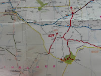
the New Mexico map
West of here the land goes high with pine and aspen forests. Lots of aspen, must be a great drive in the fall. This in turn changes back to desert eventually as I drive on to Farmington and then Shiprock. I had thought to camp around here but the area is not attractive. Farmington has giant car cemeteries and multiple pawn shops. That's what I noticed, anyway. Shiprock is very dry and brown. From there it's north across the Navajo Nation to Colorado.

Wednesday, May 11, 2011

Carlsbad Caverns (5/9/11-5/10)

the McDonald Observatory
approaching the Guadalupes
Recommended to me by several people, Carlsbad happened to be directly in my path so that's where I headed. Fort Davis is in the Davis Mountains and because hardly anyone lives out this way, the Observatory pictured is on top of a hill only 15 minutes, or so, north of town. Beyond the mountains the land flattens out once again and it pretty much remains that way all the way north to the Guadalupe Mountains N.P. The drive to Whites City just south of Carlsbad was 186 miles and 3-1/2 hours.

Whites City is on the highway about 7 miles from the Carlsbad Caverns visitor's center. Named after Jim White, the man who began exploring the caverns over 110 years ago as a teenager, the town was sold by the White family several years ago in an auction. To me, the "town" is the place to stay as Carlsbad itself is just more driving and not very attractive. I stayed in their campground.

down to the natural entrance
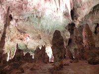
cave
It's amazing to know that Jim White and others walked into and out of these enormous caverns with rope ladders and lanterns. Today, the path is paved with handrails the entire way in from the natural entrance. Some people elect to use the elevator that takes you directly to the bottom and to what is called the Big Room. It's a steep walk down through the natural entrance some 800 feet, but well worth it. Everyone takes the elevator back to the surface.


cave

cave

cave
I'm attaching a few of the pictures that came out at all, no need to put a title on them. You might want to click to enlarge to see any detail. The caverns are beautiful, magical and truely exceptional. I can't recommend them enough. I can see coming back here some day to take one or two of the ranger-guided trips into areas that are not normally open to the public. Some of it looks like a winter wonderland the way it's been strategically lit up. Let me put it this way...it's tee shirt worthy.

Monday, May 9, 2011

The Fatherland (5/7/11-5/8)

Presidio

waiting in line
north towards Marfa
I'm so happy to be driving across the bridge, I don't even notice the river below. Just on the other side are two lanes of vehicles waiting to go through US customs. After 15-20 minutes it's my turn. The officer asks for my passport and scans it, then asks a few harmless questions - do I have anything to declare, what's that thing on the roof, what was I doing in Mexico - and waves me through. It's official. After 220 days and 11644 miles, I'm back in. What can I say?, it feels good.


Lincoln's Profile
The town itself holds no attraction for me, so it's back to driving north through more of the same kind of country. Maybe 10 miles up the road there is one of those little blue signs to indicate a point of interest, and it says "Lincoln's Profile" with an arrow pointing left. I look over and damn if it aint the President hisself justa lying there. I had to stop and take this photo of the ridge in the distance...uncanny.


Fort Davis


my all-American meal
the fountain area
Some 80 miles north of Presidio is Fort Davis, the highest town in Texas at 5050'. The air is dry here and at night it drops into the 50's. It's a real small town, peaceful, neat as a pin, and I park on the main street across from the drugstore. This is an old-fashioned drugstore with a soda fountain and restaurant and it's about 4 o'clock and I'm starving. I can't resist ordering up a root beer float (with chocolate ice cream) with a 1/2 lb. Texas-size hamburger and fries. Hot damn, it's tastes great!!


to Fort Davis, Texas

The campground is only a block from the drugstore and I'm the only camper for my two nights here. The caretaker, Jim, tells me some of the history around here. The town and the county are named for Jefferson Davis and Lily Langtry and Judge Roy Bean used to hang out here. Not much else to do except reflect on the biggest trip of my life. It seems like it was no big deal now, just a nice long drive. I'm probably proudest of the fact that I not only survived, but that I thrived. And so many good people along the way, I'm trying to remember their names. I guess that's what the blog is really for. This blog will keep going until I pull back into Golden, CO. I'm off to Carlsbad next.

Sunday, May 8, 2011

Due North (5/5/11-5/7)

Zacatecas

south of Zacatecas
Having said my goodbyes to Barb and Sal, I hit the road around 11am to begin the ride north to the border. I had been to Zacatecas 5 years earlier and would include it in my list of favorite colonial cities - a list that keeps growing - but this time it's only a pit stop. As I started driving, the thought of getting back into the US became my primary motivation. I'm ready to leave Mexico.


Mazamitla to Zacatecas
black is prior trip
click to enlarge
The country north of Mazamitla is hilly and pretty and there is even some green, but north of Aguascalientes it becomes drier and more like desert. You'll see most of the pictures are interchangeable. It takes me 6-1/4 hours to cover 243 miles and to get to your basic interstate business hotel - a CityExpress, new, clean and secure - north of the city of Zacatecas.


Hildago del Parral

south of Parral
My next destination, this drive was a big one taking 8-1/2 hours to go 426 miles. Except for a short piece of toll road north of Zacatecas, it's all free road. Of note, somewhere north of Zacatecas I cross over the Tropic of Cancer, thus ending the 'tropic' portion of this trip.

Once north of Durango, there are hardly any trucks and very few towns, meaning very few topes. The roads are in great shape and speeds of 50-70 are the norm. And only one military checkpoint, which I get waved through. Parral is another town I had been to on my first trip and I chose to stay in the same convenient hotel, the American Inn, also clean and secure.

Ojinaga

on the way to Chihuahua
towards Ojinaga
This is the border town northeast of Chihuahua across from Presidio, Texas. It's fairly remote which means it should be quieter and easier to cross. And there aren't any drug dudes around here, at least that's what I read. More free road north of Parral, all safe and fast two-lane going through desert country with few towns. The full trip takes 5-1/2 hours and 289 miles, with about 45 minutes of that used to wend my way through Chihuahua and buy gas.


my last checkpoint

Past Chihuahua, still more good two-lane with little traffic. About 35 miles out, there is a new toll road option that I elect to take. Anything to make the ride through this desert go faster, and it only cost $7. Finally arrive in Ojinaga, known locally as OJ. It's like a fricking frying pan here. And I run into the only military checkpoint of the day, surprising to me since I've been driving in the border area for a while. This is a pretty serious one, all camo. and rifles and face masks (note the guy next to my car in the photo - click to enlarge). They even look around in the car.


my last border...B14

the 715 miles from
Zacatecas to Ojinaga

I buy more gas - it's less than $3 here - and head to the border on the river. I had forgotten to pay for my tourist pass when entering via Belize so I lost close to an hour fixing that. You also have to be sure to cancel out the vehicle pass if you want to ever get back in, which I do. After that, I simply drive over the Rio Grande (there's a 21 peso toll), and I'm back, back in the U.S.A.!!

Friday, May 6, 2011

Troncones and Mazamitla (4/29/11-5/4)

Entonces, Troncones

'Entonces' is a word I never learned in school, yet it's a common, everyday word. It means 'then'. I thought it sounded good in the title. It's a long 253 miles over 6-1/2 hours to get from Playa Ventura to Troncones. The coast highway is one of those fast/slow roads. You get to go fast for a mile or five before another town with topes shows up. Plus, it does a lot of winding back and forth. Everything is brown awaiting the rainy season, and countless fields are set afire to clear for planting, leaving an annoying haze.

seaside food shacks
look for the La Fogata
North of Acapulco and 80 miles south of Zhuatanejo is the restaurant pictured. I stopped there for lunch and for 40 pesos I ate like a king. And the salsa adobo is the best combination of sweet and heat to come out of Mexico since Salma Hayek. Further along the coast road the ocean comes into view from time to time. Often, when there is any kind of space you'll find food shacks crammed in between the road and the beach, like in the picture.

 
the shower
Troncones
Making my way through the traffic zoo that is Zihua., the Troncones road is about another 20 minutes north. Much quieter and mostly upscale - rich gringos with second homes, or thirds, I suppose - I like it here. John and Sheri, from Iowa among other places, have started a small RV park in their yard across the street from the beach. It's late in the season and the heat and humidity are getting borderline, and it's too hot to even hang on the beach for very long.

My second night we walk over to the restaurant across the street and enjoy a few hours of good food and drink. John and Sheri are fun to hang with and I'd love to come back when the weather is more agreeable. Love the garden hose shower, which they promise to replace with a real shower soon. I hope this one stays.

Mazamitla

one of many cliff views
It's another challenging drive along the coast for 6 hours, and then 3 more hours north into the mountains, 344 miles in total. This marks the end of my days on the ocean, but the Michoacan coast affords some of the most beautiful views. Much of this coast is sparsely populated as it's very rough and the driving along the cliffs is very distracting.

P. Ventura to Mazamitla
black is prior trip
click to enlarge
Turning inland the road climbs towards the capital city of Colima and beyond that there is farmland cut with canyons making for more slow driving. The best thing about gaining elevation is going from 95 down to about 80. And the air is much drier. I get to use my blanket and my sleeping bag...low 50's at night. Nice.


I'm staying at the Hacienda Contreras, a campground owned by Barb and Sal, the couple I originally crossed into Mexico with way back in September, so I've been looking forward to seeing them again. The campground is outside of Mazamitla closer to the smaller town of Valle de Juarez. Both of these towns are already among my favorites. Great climate, clean, friendly and lots of good food.

Coco and the birria
Speaking of food, one day Barb and I drive into Juarez to go to the grocery store and we park on the plaza across from where Coco is serving up his special birria, something he's been doing for over 30 years. Birria is calf that has been marinated overnight and then slow cooked in the morning. It's served with a broth and all the usual sides. Think it tastes good? You would be right. 

Mazamitla church
Afterwards we drive over to the center of Mazamitla, a Pueblo Magico. I think the main magical thing about it is the pine forest climate. Many people from Guadalajara come here to vacation or have second homes. We park next to an old home and the owner invites us in to taste the family recipe for caramel. We both buy some. There is a band playing in the plaza, some of the wooden buildings look Swiss and the church here is a little different than most. All of this is magical, too.


with Sal and Barb
Even though I caught a pretty bad cold - from the drastic change in weather, I guess - Sal and Barb and I had some good meals together. They are both very kind. Sal was born and raised in Juarez so they know the entire town, it seems, making a trip into town even more special as they exchange greetings with most everyone we see. The campground is in a country setting on land Sal bought from his grandfather. This is an area I would like to come back to and spend some more time.

Wednesday, May 4, 2011

Puerto Escondido and Playa Ventura (4/26/11-4/28)

Up and Down the Mountain

the scrubby part
Oaxaca, like most cities, has a lot of sprawl and it takes me over an hour to get beyond the messy edges. After that, the  decent two-lane road, Mex. 131, goes southwest through dry highland farm country - corn mostly - and scrubby ranchland. Everything is quite dry and brown for the long, twisty drive up the mountain. How twisty was it? There were more twists in this road than at a Chubby Checker concert. There were more curves than a whole bevy of bellydancers. A lot! The last third of the drive is over the top and down onto the green side of the mountain. This section is also filled with potholes. How many potholes? More holes than it takes to fill Albert Hall. More holes than are in the plotline to the Matrix movies. A lot! It took 7-1/2 hours to go 167 miles.

Puerto Escondido

surfing off  Playa Zicatela
This was one of my favorite towns 5 years ago so I was looking forward to seeing it again. I don't know, can't put my finger on it, but I don't hold it in such high esteem anymore. It looks as though continued haphazard construction has put the town at a tipping point of no return.


looking down at the heart of P.E
where most swimming is allowed.
 I decided to get a room at the same Beach Hotel Ines on the long Playa Zicatela. This stretch is known as the Mexican Pipeline and the waves may get as high as 12 meters in the next 2 months, or so. Not a place for beginners, swimming usually isn't allowed, but it's nice to look at. The Ines has been around forever and it has a prime location and a fair amount of character. When I was in Nicaragua, I ran into a guy frm N.J. named Carlos who stayed here for years. He asked me to say hello for him if I swung by. Carlos, they - Peter and Ines - say hi back.

Playa Ventura

O. to P.E. to P.V.
black is prior trip
click to enlarge
There are a number of beach access roads and small towns as you drive up the coastal highway towards Acapulco, and about 5 hours from P.E. is Playa Ventura. Ines herself had suggested the La Tortuguita to me 5 years ago. This is a cool little place run by Julio and Ester, from Switzerland. Built from scratch, including a great pool just off the beach, I'm able to stay here for 80 pesos.

camped on lawn
5 years ago I wondered if this area would ever see any real growth since it's pretty far from everything. I had never heard of it. Now, the bumpy beach road has been paved and the empty lots on either side of Tortuguita have a small hotel and an Italian restaurant. Who knew? It's good to see Julio and Ester again, and their business has prospered with the restaurant doubling in size. The camarones diablo is delicious. The only bad thing is that some fierce storms in the last year really eroded big parts of the beach. Still, a great place to relax and break up the long drive.